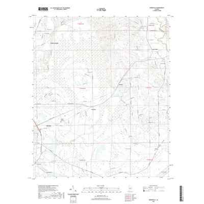
2020 Map of Burnsville
USGS Topo · Published 2020About this map
The Alabama River carves the southern boundary of this Dallas County landscape, where the urban edge of Selma meets the agricultural and marshy lowlands of central Alabama. This survey captures a mix of residential expansion and preserved natural features, including the extensive wetlands of Beech Creek Swamp and Blue Girth Swamp. To the north, the small settlements of Valley Grande, Manila, and Burnsville are connected by a network of rural roads such as Old Stage Rd and Old Burnsville Rd. Genealogists will find a high density of burial sites across this quadrangle, ranging from the large Fairlawn Memory Gardens near the city to smaller family and community grounds like Dubose Family Cemetery and Saint Luke Cemetery. The river itself remains a defining topographical element, featuring named sandbars like Tipton Bar and the curiously named Fish Trap Bar near the confluence with Mulberry Creek.
Find a feature on this map
101 named features on this map. Tap any name to fly to it.
Don’t see what you’re looking for? This feature index may not catch every label — zoom into the map to look around manually.
Map Details
Editions of this 2020 Burnsville Map
This is the sole edition of this map. No revisions or reprints were ever made.
Other maps of this area

1891 · Clanton
USGS Topo · 1:125,000

1953 · Montgomery
USGS Topo · 1:250,000

1956 · Montgomery
USGS Topo · 1:250,000

1957 · Montgomery
USGS Topo · 1:250,000

1957 · Benton
USGS Topo · 1:62,500

1958 · Selma
USGS Topo · 1:62,500

1958 · Selma
USGS Topo · 1:24,000

1959 · Plantersville
USGS Topo · 1:62,500

1959 · Summerfield
USGS Topo · 1:62,500

1975 · Benton SE
USGS Topo · 1:24,000