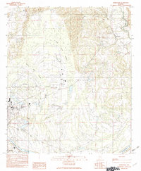
1982 Map of Burnsville
USGS Topo · Published 1983About this map
The Alabama River flows along the southern edge of this landscape, marking a transition from the agricultural lowlands near Selmont to the more varied terrain of the Dallas Co and Autauga Co border. On the western side of the sheet, the outskirts of Selma show a cluster of light industry and transport infrastructure, including several Gravel Pits and a Sand Pit. This 1980s-era geography captures a region defined by its water systems, where the meandering Mulberry Creek and the extensive wetlands of Blue Gurth Swamp dictate the placement of local settlements.
Find a feature on this map
18 named features on this map. Tap any name to fly to it.
Don’t see what you’re looking for? This feature index may not catch every label — zoom into the map to look around manually.
Map Details
Editions of this 1982 Burnsville Map
This is the sole edition of this map. No revisions or reprints were ever made.
Other maps of this area

1891 · Clanton
USGS Topo · 1:125,000

1953 · Montgomery
USGS Topo · 1:250,000

1956 · Montgomery
USGS Topo · 1:250,000

1957 · Montgomery
USGS Topo · 1:250,000

1957 · Benton
USGS Topo · 1:62,500

1958 · Selma
USGS Topo · 1:62,500

1958 · Selma
USGS Topo · 1:24,000

1959 · Plantersville
USGS Topo · 1:62,500

1959 · Summerfield
USGS Topo · 1:62,500

1975 · Benton SE
USGS Topo · 1:24,000