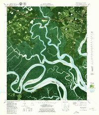
1979 Map of Burroughs
USGS Topo · Published 1979About this map
The Little Ogeechee River and Ogeechee River wind through a complex network of coastal wetlands and islands in this late-1970s orthophotomap. The landscape is defined by the transition from the upland developments near Armstrong State College and Vernonburg to the expansive salt marshes of the Middle Marsh (Grove River). These tidal systems are connected by historic waterways like Harvey Cut and are punctuated by numerous hammocks and islands, including Steadman Island and Savage Island.
Find a feature on this map
53 named features on this map. Tap any name to fly to it.
Don’t see what you’re looking for? This feature index may not catch every label — zoom into the map to look around manually.
Map Details
Editions of this 1979 Burroughs Map
4 editions found
Other maps of this area

1920 · Meldrim
USGS Topo · 1:62,500

1920 · Limerick
USGS Topo · 1:62,500

1942 · Meldrim
USGS Topo · 1:62,500

1942 · Savannah
USGS Topo · 1:62,500

1944 · Limerick
USGS Topo · 1:62,500

1944 · Ossabaw Island
USGS Topo · 1:62,500

1945 · Ossabaw Island
USGS Topo · 1:62,500

1946 · Brunswick
USGS Topo · 1:250,000

1947 · Savannah
USGS Topo · 1:250,000

1948 · Brunswick
USGS Topo · 1:250,000