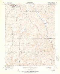
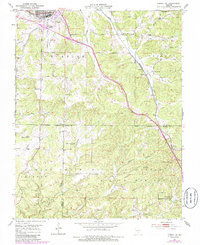
1951 Map of Cabool SE
USGS Topo · Published 1952About this map
The city of Cabool serves as the focal point for this early 1950s survey, situated at the confluence of the Big Piney River and the St Louis San Francisco railroad line. The map illustrates a landscape of the Ozark plateau where the infrastructure of the Mark Twain National Forest meets rural settlements. Transport and communication are defined by the rail corridor passing through Sargent and Sterling, with the latter featuring the Sterling Lookout Tower as a prominent forestry landmark.
Find a feature on this map
41 named features on this map. Tap any name to fly to it.
Don’t see what you’re looking for? This feature index may not catch every label — zoom into the map to look around manually.
Map Details
Editions of this 1951 Cabool SE Map
6 editions found

Other maps of this area

1939 · Topaz
USGS Topo · 1:62,500

1941 · Topaz
USGS Topo · 1:62,500

1945 · Harrison
USGS Topo · 1:250,000

1945 · Willow Springs
USGS Topo · 1:62,500

1945 · Clear Springs
USGS Topo · 1:62,500

1948 · Clear Springs
USGS Topo · 1:62,500

1948 · Willow Springs
USGS Topo · 1:62,500

1949 · Harrison
USGS Topo · 1:250,000

1949 · Rolla
USGS Topo · 1:250,000

1950 · Cabool SW
USGS Topo · 1:24,000