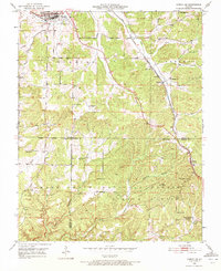
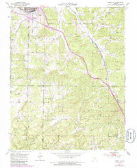
1951 Map of Cabool SE
USGS Topo · Published 1972About this map
The St Louis - San Francisco railroad cuts a diagonal path through this southern Missouri landscape, connecting the small communities of Sargent and Sterling. This mid-century survey reveals a rural society transitioning its infrastructure, noted by the presence of the Forest Flower Sch (Abandoned) in the south and active local institutions like the Sargent Sch and Pea Ridge Sch. The northern edge is anchored by the town of Cabool, where the Big Piney River flows near the junction of U.S. 60 and U.S. 63.
Find a feature on this map
34 named features on this map. Tap any name to fly to it.
Don’t see what you’re looking for? This feature index may not catch every label — zoom into the map to look around manually.
Map Details
Editions of this 1951 Cabool SE Map
6 editions found

Other maps of this area

1939 · Topaz
USGS Topo · 1:62,500

1941 · Topaz
USGS Topo · 1:62,500

1945 · Harrison
USGS Topo · 1:250,000

1945 · Willow Springs
USGS Topo · 1:62,500

1945 · Clear Springs
USGS Topo · 1:62,500

1948 · Clear Springs
USGS Topo · 1:62,500

1948 · Willow Springs
USGS Topo · 1:62,500

1949 · Harrison
USGS Topo · 1:250,000

1949 · Rolla
USGS Topo · 1:250,000

1950 · Cabool SW
USGS Topo · 1:24,000