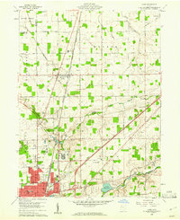
1960 Map of Cairo
USGS Topo · Published 1961About this map
Sugar Creek and Rattlesnake Creek flow through this landscape just north of Lima, where the city's northward expansion meets established farmsteads and institutional landmarks. The extensive grounds of the Lima State Hospital and St Gerards College dominate the transition from urban streets to rural townships, while the Lima Reservoir provides a significant water feature near the Ottawa River. This 1960 survey captures a period of industrial and infrastructural density, marked by the convergence of the Baltimore and Ohio Toledo and Detroit and the New York Chicago and St Louis railroads.
Find a feature on this map
56 named features on this map. Tap any name to fly to it.
Don’t see what you’re looking for? This feature index may not catch every label — zoom into the map to look around manually.
Map Details
Editions of this 1960 Cairo Map
4 editions found
Other maps of this area

1906 · Lima
USGS Topo · 1:62,500

1906 · Columbus Grove
USGS Topo · 1:62,500

1907 · Bluffton
USGS Topo · 1:62,500

1908 · Columbus Grove
USGS Topo · 1:62,500

1913 · Alger
USGS Topo · 1:48,000

1915 · Alger
USGS Topo · 1:62,500

1943 · Alger
USGS Topo · 1:62,500

1950 · Marion
USGS Topo · 1:250,000

1953 · Muncie
USGS Topo · 1:250,000

1956 · Muncie
USGS Topo · 1:250,000