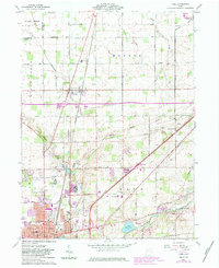
1960 Map of Cairo
USGS Topo · Published 1983About this map
The Ottawa River and the northern reaches of Lima anchor this landscape during a period of significant local infrastructure expansion. The map captures the extensive grounds of the Lima State Hospital, including its dedicated State Hospital Cem, alongside civic landmarks like the Lima Reservoir and Schoonover Park. The rural sections are defined by a network of family-named roads and small community hubs such as Cairo, Rockport, and Slabtown.
Find a feature on this map
61 named features on this map. Tap any name to fly to it.
Don’t see what you’re looking for? This feature index may not catch every label — zoom into the map to look around manually.
Map Details
Editions of this 1960 Cairo Map
4 editions found
Other maps of this area

1906 · Lima
USGS Topo · 1:62,500

1906 · Columbus Grove
USGS Topo · 1:62,500

1907 · Bluffton
USGS Topo · 1:62,500

1908 · Columbus Grove
USGS Topo · 1:62,500

1913 · Alger
USGS Topo · 1:48,000

1915 · Alger
USGS Topo · 1:62,500

1943 · Alger
USGS Topo · 1:62,500

1950 · Marion
USGS Topo · 1:250,000

1953 · Muncie
USGS Topo · 1:250,000

1956 · Muncie
USGS Topo · 1:250,000