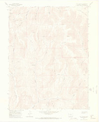
1964 Map of Calf Canyon
USGS Topo · Published 1968About this map
High-altitude plateaus and deeply carved drainages define this Colorado landscape as it appeared in the mid-1960s. The topography is dominated by massive fingers of land such as Calf Point, Barrel Spring Point, and the prominent Long Point, which separate the various forks and canyons feeding into the larger valley systems. Human presence is sparse, centered primarily on the settlement at Barrel Spring and a network of seasonal routes including a high-elevation Pack Trail and several Jeep Trails.
Find a feature on this map
32 named features on this map. Tap any name to fly to it.
Don’t see what you’re looking for? This feature index may not catch every label — zoom into the map to look around manually.
Map Details
Editions of this 1964 Calf Canyon Map
3 editions found
Other maps of this area

1956 · Grand Junction
USGS Topo · 1:250,000

1959 · Grand Junction
USGS Topo · 1:250,000

1960 · Grand Junction
USGS Topo · 1:250,000

1962 · Grand Junction
USGS Topo · 1:250,000

1964 · Grand Junction
USGS Topo · 1:250,000

1964 · Douglas Pass
USGS Topo · 1:24,000

1964 · Brushy Point
USGS Topo · 1:24,000

1964 · Henderson Ridge
USGS Topo · 1:24,000

1964 · Calf Canyon
USGS Topo · 1:24,000
1964 · Razorback Ridge
USGS Topo · 1:24,000