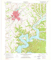
1970 Map of Campbellsville
USGS Topo · Published 1978About this map
Campbellsville serves as the focal point of this 1970s survey, showing a period of significant local infrastructure and recreational development. The campus of Campbellsville College and the Taylor County High Sch anchor the town's northern edge, while the expansion of the city is evident in the detailed street grids of South Campbellsville. The presence of the Taylor County Airport and the Fairgrounds reflects the town's role as a regional hub in central Kentucky.
Find a feature on this map
71 named features on this map. Tap any name to fly to it.
Don’t see what you’re looking for? This feature index may not catch every label — zoom into the map to look around manually.
Map Details
Editions of this 1970 Campbellsville Map
3 editions found
Other maps of this area

1952 · Mannsville
USGS Topo · 1:24,000

1952 · Bradfordsville
USGS Topo · 1:24,000

1953 · Campbellsville
USGS Topo · 1:24,000

1953 · Saloma
USGS Topo · 1:24,000

1953 · Gresham
USGS Topo · 1:24,000

1953 · Spurlington
USGS Topo · 1:24,000

1953 · Cane Valley
USGS Topo · 1:24,000

1953 · Bradfordsville
USGS Topo · 1:24,000

1954 · Knifley
USGS Topo · 1:24,000

1954 · Greensburg
USGS Topo · 1:24,000