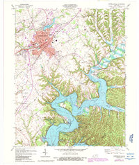
1970 Map of Campbellsville
USGS Topo · Published 1987About this map
Campbellsville serves as the focal point of this Central Kentucky landscape, showing significant urban expansion and educational development as of the 1970s. The map highlights the central business district, featuring the Courthouse and City Hall, alongside the sprawling campus of Campbellsville College. To the south and east, the character of the land shifts dramatically toward the newly formed Green River Lake, a reservoir that transformed the local topography.
Find a feature on this map
60 named features on this map. Tap any name to fly to it.
Don’t see what you’re looking for? This feature index may not catch every label — zoom into the map to look around manually.
Map Details
Editions of this 1970 Campbellsville Map
3 editions found
Other maps of this area

1952 · Mannsville
USGS Topo · 1:24,000

1952 · Bradfordsville
USGS Topo · 1:24,000

1953 · Campbellsville
USGS Topo · 1:24,000

1953 · Saloma
USGS Topo · 1:24,000

1953 · Gresham
USGS Topo · 1:24,000

1953 · Spurlington
USGS Topo · 1:24,000

1953 · Cane Valley
USGS Topo · 1:24,000

1953 · Bradfordsville
USGS Topo · 1:24,000

1954 · Knifley
USGS Topo · 1:24,000

1954 · Greensburg
USGS Topo · 1:24,000