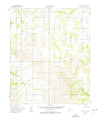
1950 Map of Candle C-5
USGS Topo · Published 1977About this map
The remote Seward Peninsula landscape is meticulously documented in this mid-century survey, reflecting a period of exploration and small-scale habitation in Alaska's interior. Defined by the prominent Weather Ridge, the terrain is a complex network of drainage systems, including the Left Fork Hunter Creek and Fairhaven Creek. Evidence of human activity is sparse but significant, concentrated around isolated clusters of Cabins and a lone Cabin in the southern reaches. The presence of a Tractor Trail cutting through the valleys near Quartz Creek and a dedicated Landing Strip in the east underscores the reliance on rugged transport and aviation to access this wilderness. These features, along with numerous named waterways like Kiilukipuk Creek and Sheridan Creek, provide a detailed record of the region's geography before later environmental shifts or development changed the face of the Alaskan bush.
Find a feature on this map
27 named features on this map. Tap any name to fly to it.
Don’t see what you’re looking for? This feature index may not catch every label — zoom into the map to look around manually.
Map Details
Editions of this 1950 Candle C-5 Map
3 editions found
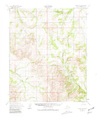
Other maps of this area

1950 · Candle C-5
USGS Topo · 1:63,360

1950 · Candle B-5
USGS Topo · 1:63,360

1950 · Candle B-6
USGS Topo · 1:63,360

1950 · Candle C-6
USGS Topo · 1:63,360

1951 · Candle
USGS Topo · 1:250,000

1951 · Candle D-5
USGS Topo · 1:63,360

1951 · Candle D-6
USGS Topo · 1:63,360

1955 · Candle
USGS Topo · 1:250,000

1955 · Candle D-4
USGS Topo · 1:63,360

1955 · Candle C-4
USGS Topo · 1:63,360