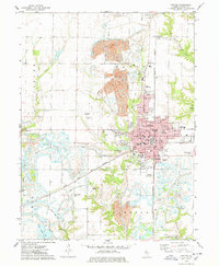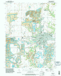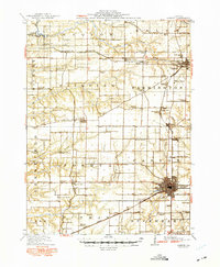
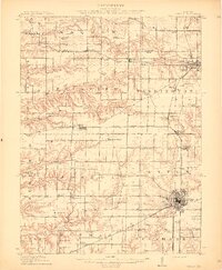
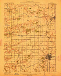
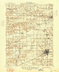
1912 Map of Canton
USGS Topo · Published 1949About this map
The coal-rich landscape of Fulton County is revealed in this early 20th-century survey, showcasing a dense network of underground resources and rural infrastructure. Operations such as Alden Mine No 5, Maplewood Mine No 1, and Star Mine No 1 define the regional economy, while the Chicago Burlington and Quincy RR and Minneapolis and St Louis RR provide the essential transit corridors for industry and commuters. The map documents an era of dispersed local education, with dozens of one-room schoolhouses like Hazel Dell School, Pisgah School, and Mound School serving the farming and mining families between the larger hubs of Canton and Farmington. Significant local landmarks, including the County Farm and settlements like Brereton and Norris, offer a detailed view of the county's social geography before mid-century modernization transformed the prairie.
Find a feature on this map
93 named features on this map. Tap any name to fly to it.
Don’t see what you’re looking for? This feature index may not catch every label — zoom into the map to look around manually.
Map Details
Editions of this 1912 Canton Map
4 editions found
Historical Maps of Canton Through Time
8 maps found