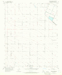
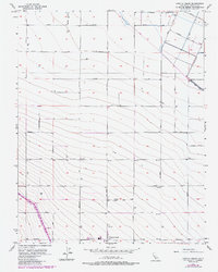
1956 Map of Cantua Creek
USGS Topo · Published 1957About this map
Deep agricultural development and precise irrigation infrastructure define this Fresno County landscape in the mid-1950s. The northern reaches are bisected by the Beta Main Canal, part of a complex water management system essential for the surrounding fields, while Cantua Creek meanders through the southern sections. The map reveals a strictly gridded landscape dominated by named avenues such as Mountain View Ave and Oil City Ave, reflecting the systematic settlement and industrial layout of the Central Valley. Scattered throughout the townships are numerous well sites and utility features like a Res Pump and a Water Tank, alongside the Landing Strip, signaling the area's reliance on aerial agriculture and petroleum exploration. The name Stroud appears as a specific local landmark amidst the vast network of roads including James Ave and Marin Ave.
Find a feature on this map
42 named features on this map. Tap any name to fly to it.
Don’t see what you’re looking for? This feature index may not catch every label — zoom into the map to look around manually.
Map Details
Editions of this 1956 Cantua Creek Map
5 editions found
Other maps of this area

1912 · Coalinga
USGS Topo · 1:125,000

1922 · Tufts Ranch
USGS Topo · 1:31,680

1923 · Levis
USGS Topo · 1:31,680

1923 · Englebrecht Ranch
USGS Topo · 1:31,680

1924 · Jamesan
USGS Topo · 1:31,680

1924 · Tranquillity
USGS Topo · 1:31,680

1925 · San Joaquin
USGS Topo · 1:31,680

1931 · Towne Oil Station
USGS Topo · 1:31,680

1931 · Mouth of Cantua Creek
USGS Topo · 1:31,680

1943 · Joaquin Rocks
USGS Topo · 1:62,500