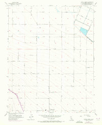
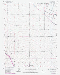
1956 Map of Cantua Creek
USGS Topo · Published 1972About this map
Cantua Creek serves as a focal point for this agrarian portion of Fresno County, where a strictly organized grid of county roads defines the landscape. Named for California’s famous inland counties, the thoroughfares—including Stanislaus Ave, Tuolumne Ave, and Calaveras Ave—parcel out the valley floor for large-scale cultivation. The transition of the region’s water management is visible through the massive curve of the California Aqueduct slicing across the southwestern corner, contrasting with the engineered linearity of the Beta Main Canal in the northeast. Numerous irrigation wells are scattered throughout the sections, reflecting the heavy reliance on groundwater prior to the full expansion of state water projects. The presence of Oil City Ave and a solitary Water Tank near the settlement hint at the local infrastructure supporting both farming operations and the nearby petroleum industry during the mid-20th century.
Find a feature on this map
42 named features on this map. Tap any name to fly to it.
Don’t see what you’re looking for? This feature index may not catch every label — zoom into the map to look around manually.
Map Details
Editions of this 1956 Cantua Creek Map
5 editions found
Other maps of this area

1912 · Coalinga
USGS Topo · 1:125,000

1922 · Tufts Ranch
USGS Topo · 1:31,680

1923 · Levis
USGS Topo · 1:31,680

1923 · Englebrecht Ranch
USGS Topo · 1:31,680

1924 · Jamesan
USGS Topo · 1:31,680

1924 · Tranquillity
USGS Topo · 1:31,680

1925 · San Joaquin
USGS Topo · 1:31,680

1931 · Towne Oil Station
USGS Topo · 1:31,680

1931 · Mouth of Cantua Creek
USGS Topo · 1:31,680

1943 · Joaquin Rocks
USGS Topo · 1:62,500