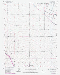
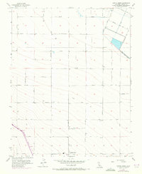
1956 Map of Cantua Creek
USGS Topo · Published 1984About this map
The settlement of Cantua Creek serves as the focal point for this section of the San Joaquin Valley, where the landscape is defined by an intensive grid of agricultural infrastructure and water management. Surveyed in the mid-1950s with later updates, the map documents a transition in water engineering, most notably featuring the Governor Edmund G Brown California Aqueduct cutting diagonally across the southwestern corner. The regular spacing of named roads, such as Monterey Ave and Manning Ave, along with numerous wells and the Main Canal, illustrates the systematic development of this arid region into a productive farming district. Local landmarks like the Water Tank near the main settlement and specialized corridors like Oil City Ave reflect the region's specific industrial and agricultural requirements during the latter half of the twentieth century.
Find a feature on this map
29 named features on this map. Tap any name to fly to it.
Don’t see what you’re looking for? This feature index may not catch every label — zoom into the map to look around manually.
Map Details
Editions of this 1956 Cantua Creek Map
5 editions found
Other maps of this area

1912 · Coalinga
USGS Topo · 1:125,000

1922 · Tufts Ranch
USGS Topo · 1:31,680

1923 · Levis
USGS Topo · 1:31,680

1923 · Englebrecht Ranch
USGS Topo · 1:31,680

1924 · Jamesan
USGS Topo · 1:31,680

1924 · Tranquillity
USGS Topo · 1:31,680

1925 · San Joaquin
USGS Topo · 1:31,680

1931 · Towne Oil Station
USGS Topo · 1:31,680

1931 · Mouth of Cantua Creek
USGS Topo · 1:31,680

1943 · Joaquin Rocks
USGS Topo · 1:62,500