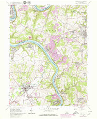
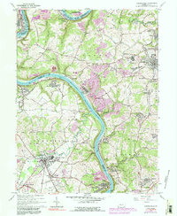
1964 Map of Carmichaels
USGS Topo · Published 1979About this map
The Monongahela River carves a deep, winding path through this corner of the Appalachian Plateau, separating the coal-rich landscapes of Fayette, Greene, and Washington Counties. By the early 1960s, the region’s industrial identity is etched into the terrain through extensive Strip Mine operations and prominent Mine Dump sites. Settlements like Crucible, Isabella, and Republic appear as compact company-built towns, many originally established to support the nearby collieries and river transport.
Find a feature on this map
76 named features on this map. Tap any name to fly to it.
Don’t see what you’re looking for? This feature index may not catch every label — zoom into the map to look around manually.
Map Details
Editions of this 1964 Carmichaels Map
5 editions found
Other maps of this area

1900 · Masontown
USGS Topo · 1:62,500

1901 · Amity
USGS Topo · 1:62,500

1901 · Waynesburg
USGS Topo · 1:62,500

1902 · Brownsville
USGS Topo · 1:62,500

1903 · Masontown
USGS Topo · 1:62,500

1904 · Amity
USGS Topo · 1:62,500

1904 · Waynesburg
USGS Topo · 1:62,500

1906 · Brownsville
USGS Topo · 1:62,500

1931 · Brownsville
USGS Topo · 1:62,500

1931 · Masontown
USGS Topo · 1:62,500