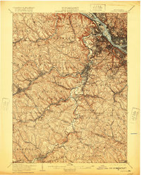
1906 Map of Carnegie
USGS Topo · Published 1920About this map
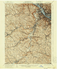
Chartiers Creek serves as the central artery for this industrial landscape, where the confluence of the Ohio River, Allegheny R, and Monongahela R shapes the northern boundary. The terrain is characterized by a dense network of early 20th-century railroads, including the Pennsylvania RR and the Wabash RR, which supported the region's burgeoning extraction and manufacturing economy. Settlements such as Imperial and Cliff Mine highlight the era's reliance on mineral resources, while the presence of the County Home near Woodville reflects the social infrastructure of the time. Local travel was facilitated by historic routes like the Steubenville Pike, connecting hilltop communities to the industrial valleys. Significant industrial hubs like Carnegie and Crafton appear in high detail, showing the early urban footprint of these established boroughs before the expansion of modern suburbs.
Find a feature on this map
112 named features on this map. Tap any name to fly to it.
Don’t see what you’re looking for? This feature index may not catch every label — zoom into the map to look around manually.
Map Details
Editions of this 1906 Carnegie Map
7 editions found


Other maps of this area

1901 · Amity
USGS Topo · 1:62,500

1901 · Beaver
USGS Topo · 1:62,500

1902 · Brownsville
USGS Topo · 1:62,500

1904 · Amity
USGS Topo · 1:62,500

1904 · Mc Keesport
USGS Topo · 1:62,500

1904 · Beaver
USGS Topo · 1:62,500

1904 · Carnegie
USGS Topo · 1:62,500

1904 · Burgettstown
USGS Topo · 1:62,500

1906 · Brownsville
USGS Topo · 1:62,500

1906 · Burgettstown
USGS Topo · 1:62,500