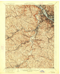
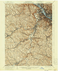
1906 Map of Carnegie
USGS Topo · Published 1927About this map
Chartiers Creek and its many tributaries, including Montour Run and Robinson Run, define the industrial and residential topography of this western Pennsylvania region during the early twentieth century. The map documents an intricate lattice of transportation and extraction, centered on the Ohio River and Brunot Island. Heavy rail infrastructure, such as the Pittsburgh Cincinnati Chicago and St Louis RR and the Wabash Pittsburgh Terminal RR, links coal-producing settlements like Cliff Mine to industrial hubs. Notable local institutions are captured, including the Union Church near Gayly and the County Home near Woodville. The southern portion of the sheet transitions into Washington County, showing the established street grids of Canonsburg and Houston alongside rural post offices like Cladden (Gradatim PO) and Lawrence (Hills PO), providing a clear view of the area's development before mid-century suburbanization.
Find a feature on this map
108 named features on this map. Tap any name to fly to it.
Don’t see what you’re looking for? This feature index may not catch every label — zoom into the map to look around manually.
Map Details
Editions of this 1906 Carnegie Map
7 editions found


Other maps of this area

1901 · Amity
USGS Topo · 1:62,500

1901 · Beaver
USGS Topo · 1:62,500

1902 · Brownsville
USGS Topo · 1:62,500

1904 · Amity
USGS Topo · 1:62,500

1904 · Mc Keesport
USGS Topo · 1:62,500

1904 · Beaver
USGS Topo · 1:62,500

1904 · Carnegie
USGS Topo · 1:62,500

1904 · Burgettstown
USGS Topo · 1:62,500

1906 · Brownsville
USGS Topo · 1:62,500

1906 · Burgettstown
USGS Topo · 1:62,500