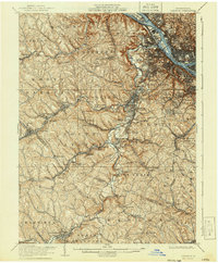
1906 Map of Carnegie
USGS Topo · Published 1940About this map
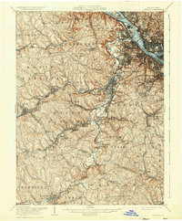
Chartiers Creek carves a deep path through the industrial heart of western Pennsylvania, anchoring a landscape defined by turn-of-the-century coal mining and rail expansion. The region is a dense network of early 20th-century transportation, where the Pittsburgh and Lake Erie RR and the Wabash RR intersect with small mining settlements and post offices. The map reveals the early development of Carnegie, Crafton, and Castle Shannon, alongside specialized locations like the Cliff Mine and Heidelberg. Along the northern edge, the confluence of the Ohio River, Allegheny River, and Monongahela River showcases the strategic significance of river islands like Neville Island and Brunot Island. This survey provides researchers a view of the area before the full suburbanization of the South Hills, preserving the locations of vanished stations and family-named landmarks such as McMinn and Ewingsville.
Find a feature on this map
104 named features on this map. Tap any name to fly to it.
Don’t see what you’re looking for? This feature index may not catch every label — zoom into the map to look around manually.
Map Details
Editions of this 1906 Carnegie Map
7 editions found


Other maps of this area

1901 · Amity
USGS Topo · 1:62,500

1901 · Beaver
USGS Topo · 1:62,500

1902 · Brownsville
USGS Topo · 1:62,500

1904 · Amity
USGS Topo · 1:62,500

1904 · Mc Keesport
USGS Topo · 1:62,500

1904 · Beaver
USGS Topo · 1:62,500

1904 · Carnegie
USGS Topo · 1:62,500

1904 · Burgettstown
USGS Topo · 1:62,500

1906 · Brownsville
USGS Topo · 1:62,500

1906 · Burgettstown
USGS Topo · 1:62,500