
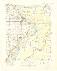
1939 Map of Caruthersville
USGS Topo · Published 1943About this map
Caruthersville sits at the heart of this 1939 survey, protected by a complex system of river engineering including a Seawall and the Caruthersville Revetment. The Mississippi River dominates the landscape, its shifting course marked by Little Prairie Bend and numerous islands such as Island No. 16. The region's agricultural and industrial character is evident through the dense network of drainage canals and the presence of the St. Louis Southwestern and Missouri San Francisco railroads.
Find a feature on this map
59 named features on this map. Tap any name to fly to it.
Don’t see what you’re looking for? This feature index may not catch every label — zoom into the map to look around manually.
Map Details
Editions of this 1939 Caruthersville Map
2 editions found
Other maps of this area

1925 · Reelfoot Lake
USGS Topo · 1:62,500

1939 · Reelfoot Lake
USGS Topo · 1:62,500

1939 · Portageville
USGS Topo · 1:62,500

1939 · Dyersburg
USGS Topo · 1:62,500

1939 · Hales Point
USGS Topo · 1:62,500

1939 · Halls
USGS Topo · 1:62,500

1939 · Blytheville
USGS Topo · 1:62,500

1940 · Pascola
USGS Topo · 1:62,500

1940 · Hayti
USGS Topo · 1:62,500

1951 · Caruthersville
USGS Topo · 1:62,500