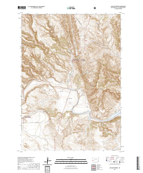
2021 Map of Cascade Springs
USGS Topo · Published 2021About this map
Cascade Springs and Rocky Ford anchor this southern Black Hills landscape where the Cheyenne River cuts through a complex system of canyons and flats. The terrain is defined by dramatic elevation changes, from the heights of Flagpole Mtn and Tepee Mtn down to the hydrologically active corridor containing Cascade Falls, Cool Spring, and Bridal Veil Spring. This modern survey reveals a patchwork of public and private lands, with significant portions of the Black Hills National Forest covering the northern and western sections. Cultural history is preserved at the Highland Cemetery and along historic transit routes like Rocky Ford Road and Cascade Road. The map provides a clear view of the area's geography, including named topographic features like Sorghum Flat, Coffee Flat, and the distinct Horseshoe Bend of the river.
Find a feature on this map
45 named features on this map. Tap any name to fly to it.
Don’t see what you’re looking for? This feature index may not catch every label — zoom into the map to look around manually.
Map Details
Editions of this 2021 Cascade Springs Map
This is the sole edition of this map. No revisions or reprints were ever made.
Other maps of this area

1896 · Oelrichs
USGS Topo · 1:125,000

1900 · Oelrichs
USGS Topo · 1:125,000

1902 · Edgemont
USGS Topo · 1:125,000

1950 · Hot Springs
USGS Topo · 1:24,000

1950 · Heppner
USGS Topo · 1:24,000

1950 · Cascade Springs
USGS Topo · 1:24,000

1950 · Angostura Reservoir
USGS Topo · 1:24,000

1950 · Rumford
USGS Topo · 1:24,000

1950 · Minnekahta
USGS Topo · 1:24,000

1950 · Flint Hill
USGS Topo · 1:24,000