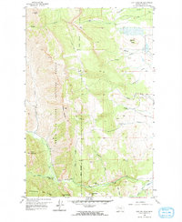
1958 Map of Cave Mountain
USGS Topo · Published 1967About this map
The eastern front of the Lewis and Clark National Forest dominates this landscape, where the high peaks of the Rockies meet the Montana plains. Higher elevations such as Mount Werner and Chateau Mountain overlook a complex drainage system where Muddy Creek and the Teton R flow eastward. This 1950s survey captures a transition between wilderness and managed rangeland, evidenced by a pack trail winding through the forest and established homesteads like the Burfening Ranch and Lazy P Ranch on the lower slopes. A notable Indian Burial Ground is located near Rinker Creek, while evidence of natural resource exploration appears at a lone Oil Well near the northern forest boundary. Geographic landmarks like Indian Head Rock and Grab Butte serve as orientation points for researchers tracing the historical trails of Teton County.
Find a feature on this map
28 named features on this map. Tap any name to fly to it.
Don’t see what you’re looking for? This feature index may not catch every label — zoom into the map to look around manually.
Map Details
Editions of this 1958 Cave Mountain Map
3 editions found
Other maps of this area

1903 · Saypo
USGS Topo · 1:125,000

1914 · Heart Butte
USGS Topo · 1:125,000

1918 · Heart Butte
USGS Topo · 1:125,000

1955 · Choteau
USGS Topo · 1:250,000

1957 · Choteau
USGS Topo · 1:250,000

1958 · Choteau
USGS Topo · 1:250,000

1958 · Ear Mountain
USGS Topo · 1:24,000

1958 · Lake Theboe
USGS Topo · 1:24,000

1958 · Cave Mountain
USGS Topo · 1:24,000

1958 · Mount Wright
USGS Topo · 1:24,000