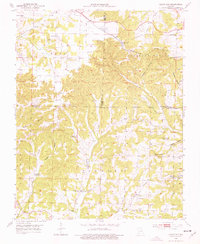
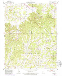
1951 Map of Cedar Gap
USGS Topo · Published 1976About this map
The St Louis - San Francisco railroad cuts a diagonal path across the rugged Ozark terrain of Douglas, Wright, and Webster counties, anchoring the small settlement of Cedar Gap. This early 1950s survey reflects a changing rural landscape, where several local education centers like Skylight Sch and Granada Sch are marked as abandoned, likely following the post-war trend of school consolidation.
Find a feature on this map
36 named features on this map. Tap any name to fly to it.
Don’t see what you’re looking for? This feature index may not catch every label — zoom into the map to look around manually.
Map Details
Editions of this 1951 Cedar Gap Map
5 editions found
Other maps of this area

1936 · Ava
USGS Topo · 1:48,000

1937 · Bradleyville
USGS Topo · 1:48,000

1939 · Fordland
USGS Topo · 1:62,500

1942 · Fordland
USGS Topo · 1:62,500

1942 · Ava
USGS Topo · 1:62,500

1943 · Bradleyville
USGS Topo · 1:62,500

1945 · Ava
USGS Topo · 1:62,500

1945 · Harrison
USGS Topo · 1:250,000

1945 · Bradleyville
USGS Topo · 1:62,500

1949 · Harrison
USGS Topo · 1:250,000