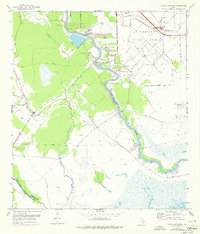
1952 Map of Cedar Lane NE
USGS Topo · Published 1976About this map
The San Bernard River winds through this coastal Texas landscape, marking a prominent physical and economic boundary. To the northeast, the extensive grounds of the Clemens State Farm dominate the terrain, defined by a network of drainage canals and a clear State Farm Boundary. This area is characterized by the intersection of industrial activity and rural life, featuring a Sulphur Plant and Sulphur Wells near the Missouri Pacific railroad line. Along the river, local history is visible through the Hinckles Ferry crossing and communal centers like Galilee Ch. To the west, the landscape transitions into more open country, where Jerusalem Sch served the local community. The map also captures the intricate drainage of the region with Cocklebur Slough and Cedar Lake Creek flowing toward the Gulf, while man-made additions like an Aqueduct and a Levee illustrate 20th-century water management efforts.
Find a feature on this map
16 named features on this map. Tap any name to fly to it.
Don’t see what you’re looking for? This feature index may not catch every label — zoom into the map to look around manually.
Map Details
Editions of this 1952 Cedar Lane NE Map
Other maps of this area

1943 · Jones Creek
USGS Topo · 1:31,680

1943 · Cedar Lakes East
USGS Topo · 1:24,000

1943 · Snipe
USGS Topo · 1:31,680

1950 · Houston
USGS Topo · 1:250,000

1951 · Bay City
USGS Topo · 1:250,000

1952 · Sweeny
USGS Topo · 1:24,000

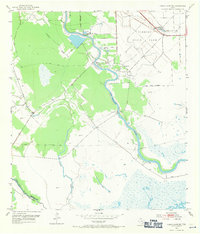
1952 · Cedar Lane NE
USGS Topo · 1:24,000

1952 · Cedar Lakes West
USGS Topo · 1:24,000

1952 · Brazoria
USGS Topo · 1:24,000

1952 · Cedar Lane
USGS Topo · 1:24,000