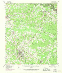
1958 Map of Center
USGS Topo · Published 1970About this map
Center serves as the focal point of this Shelby County survey, positioned at the junction of the Atchison Topeka and Santa Fe and the Southern Pacific railroads. The map documents a landscape in transition during the late 1950s and late 1960s, notably showing the emergence of the Toledo Bend Reservoir along the Sabine River border with Louisiana. This engineering project altered the local geography, inundating several low-lying areas while preserving the dense woods of the Sabine National Forest.
Find a feature on this map
115 named features on this map. Tap any name to fly to it.
Don’t see what you’re looking for? This feature index may not catch every label — zoom into the map to look around manually.
Map Details
Editions of this 1958 Center Map

Other maps of this area

1944 · Logansport
USGS Topo · 1:62,500

1944 · Patroon
USGS Topo · 1:62,500

1945 · Grand Cane
USGS Topo · 1:62,500

1945 · Socagee Bayou
USGS Topo · 1:62,500

1953 · Alexandria
USGS Topo · 1:250,000

1953 · Palestine
USGS Topo · 1:250,000

1955 · Shreveport
USGS Topo · 1:250,000

1955 · Alexandria
USGS Topo · 1:250,000

1956 · Shreveport
USGS Topo · 1:250,000

1956 · Tyler
USGS Topo · 1:250,000