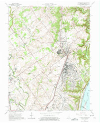
1963 Map of Charlestown
USGS Topo · Published 1964About this map
The Indiana Arsenal dominates the southeastern quadrant of this region, reflecting a landscape heavily defined by mid-century military infrastructure along the Ohio River. Located in Clark County, the city of Charlestown serves as a central hub, surrounded by a network of smaller communities like Speed, Sellersburg, and Prather. This era shows a transition from rural agricultural land to industrial and military use, evidenced by the presence of Storage Bins, multiple Water Tanks, and expansive tailings near the local Quarry.
Find a feature on this map
83 named features on this map. Tap any name to fly to it.
Don’t see what you’re looking for? This feature index may not catch every label — zoom into the map to look around manually.
Map Details
Editions of this 1963 Charlestown Map
4 editions found
Other maps of this area

1905 · Prospect
USGS Topo · 1:62,500

1912 · Prospect
USGS Topo · 1:62,500

1937 · Jeffersonville
USGS Topo · 1:24,000

1937 · Charlestown
USGS Topo · 1:24,000

1938 · Owen
USGS Topo · 1:24,000

1938 · Speed
USGS Topo · 1:24,000

1939 · New Albany
USGS Topo · 1:24,000

1946 · Jeffersonville
USGS Topo · 1:24,000

1946 · New Albany
USGS Topo · 1:24,000

1947 · Speed
USGS Topo · 1:24,000