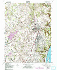
1963 Map of Charlestown
USGS Topo · Published 1993About this map
The U S Military Reservation Indiana Arsenal dominates the eastern landscape of this Indiana riverfront quadrangle, reflecting the significant federal presence in Clark Co during the mid-20th century. The intricate layout of the arsenal, complete with Patrol Road and storage bins, stands in stark contrast to the surrounding rural and industrial patterns. To the west, the town of Charlestown serves as a central hub, featuring local landmarks such as St Michaels Sch and St Michaels Ch.
Find a feature on this map
63 named features on this map. Tap any name to fly to it.
Don’t see what you’re looking for? This feature index may not catch every label — zoom into the map to look around manually.
Map Details
Editions of this 1963 Charlestown Map
4 editions found
Other maps of this area

1905 · Prospect
USGS Topo · 1:62,500

1912 · Prospect
USGS Topo · 1:62,500

1937 · Jeffersonville
USGS Topo · 1:24,000

1937 · Charlestown
USGS Topo · 1:24,000

1938 · Owen
USGS Topo · 1:24,000

1938 · Speed
USGS Topo · 1:24,000

1939 · New Albany
USGS Topo · 1:24,000

1946 · Jeffersonville
USGS Topo · 1:24,000

1946 · New Albany
USGS Topo · 1:24,000

1947 · Speed
USGS Topo · 1:24,000