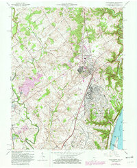
1963 Map of Charlestown
USGS Topo · Published 1981About this map
The U S Military Reservation Indiana Arsenal dominates the southeastern portion of this landscape, a massive industrial and military footprint situated along the Ohio River. Revised from 1930s topography with updates into the early 1980s, the map illustrates the expansion of Charlestown and the complex infrastructure supporting the arsenal, including an extensive network of Patrol Road segments, internal streets like Avenue D, and the Baltimore and Ohio railroad line.
Find a feature on this map
85 named features on this map. Tap any name to fly to it.
Don’t see what you’re looking for? This feature index may not catch every label — zoom into the map to look around manually.
Map Details
Editions of this 1963 Charlestown Map
4 editions found
Other maps of this area

1905 · Prospect
USGS Topo · 1:62,500

1912 · Prospect
USGS Topo · 1:62,500

1937 · Jeffersonville
USGS Topo · 1:24,000

1937 · Charlestown
USGS Topo · 1:24,000

1938 · Owen
USGS Topo · 1:24,000

1938 · Speed
USGS Topo · 1:24,000

1939 · New Albany
USGS Topo · 1:24,000

1946 · Jeffersonville
USGS Topo · 1:24,000

1946 · New Albany
USGS Topo · 1:24,000

1947 · Speed
USGS Topo · 1:24,000