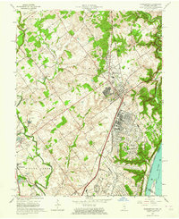
1963 Map of Charlestown
USGS Topo · Published 1975About this map
Industrial and military infrastructure dominates the landscape of southern Clark County in the early 1960s. The U S Military Reservation Indiana Arsenal occupies a massive footprint east of Charlestown, featuring an extensive network of storage bins, internal roads, and specialized facilities. The Baltimore and Ohio railroad serves this corridor, with Clark Siding and a dedicated radio tower near Pleasant Ridge highlighting the logistical importance of the area.
Find a feature on this map
76 named features on this map. Tap any name to fly to it.
Don’t see what you’re looking for? This feature index may not catch every label — zoom into the map to look around manually.
Map Details
Editions of this 1963 Charlestown Map
4 editions found
Other maps of this area

1905 · Prospect
USGS Topo · 1:62,500

1912 · Prospect
USGS Topo · 1:62,500

1937 · Jeffersonville
USGS Topo · 1:24,000

1937 · Charlestown
USGS Topo · 1:24,000

1938 · Owen
USGS Topo · 1:24,000

1938 · Speed
USGS Topo · 1:24,000

1939 · New Albany
USGS Topo · 1:24,000

1946 · Jeffersonville
USGS Topo · 1:24,000

1946 · New Albany
USGS Topo · 1:24,000

1947 · Speed
USGS Topo · 1:24,000