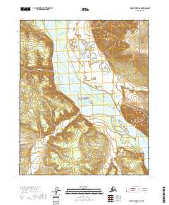
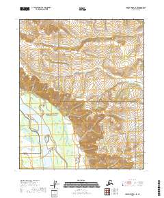
2018 Map of Charley River B-6 NE
USGS Topo · Published 2018About this map
The Yukon River carves a massive, island-strewn path through the heart of this landscape within the Yukon-Charley Rivers National Preserve. High above the river's northern bank, the dramatic elevation of Takoma Bluff stands as a primary landmark, overlooking a complex network of wetlands and shifting channels. The terrain is defined by the drainage of several significant tributaries, including Takoma Cr, Eureka Cr, and the winding Thanksgiving Cr. This 2018 survey illustrates the wild character of the Interior, where the river remains the dominant force of geography. The intricate mapping of Webber Creek and its surrounding marshlands provides a detailed record of the alluvial patterns that have shaped this remote corridor for generations of travelers and researchers.
Find a feature on this map
17 named features on this map. Tap any name to fly to it.
Don’t see what you’re looking for? This feature index may not catch every label — zoom into the map to look around manually.
Map Details
Editions of this 2018 Charley River B-6 NE Map
This is the sole edition of this map. No revisions or reprints were ever made.
Other maps of this area

1951 · Charley River
USGS Topo · 1:250,000

1956 · Charley River C-5
USGS Topo · 1:63,360

1956 · Charley River C-6
USGS Topo · 1:63,360

1956 · Charley River B-6
USGS Topo · 1:63,360

1956 · Charley River B-5
USGS Topo · 1:63,360

1956 · Charley River
USGS Topo · 1:250,000
2018 · Charley River B-5 SW
USGS Topo · 1:25,000
2018 · Charley River C-5 SW
USGS Topo · 1:25,000
2018 · Charley River B-5 NW
USGS Topo · 1:25,000
2018 · Charley River C-6 SE
USGS Topo · 1:25,000