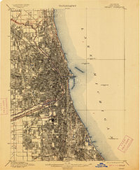
1901 Map of Chicago
USGS Topo · Published 1913About this map
The dense industrial and residential growth of Niles and the surrounding Chicago metropolis is frozen in time at the turn of the century. This survey documents a critical period of hydraulic engineering, featuring the newly completed Chicago Sanitary and Ship Canal alongside the older Illinois and Michigan Canal. These waterways, along with the North Branch and South Branch Chicago River, defined the city's early transport and sanitation corridors.
Find a feature on this map
37 named features on this map. Tap any name to fly to it.
Don’t see what you’re looking for? This feature index may not catch every label — zoom into the map to look around manually.
Map Details
Editions of this 1901 Chicago Map
5 editions found

Other maps of this area

1889 · Chicago
USGS Topo · 1:62,500

1890 · Des Plaines
USGS Topo · 1:62,500

1891 · Chicago
USGS Topo · 1:62,500

1891 · Riverside
USGS Topo · 1:62,500

1892 · Calumet
USGS Topo · 1:62,500

1893 · Calumet
USGS Topo · 1:62,500

1893 · Riverside
USGS Topo · 1:62,500

1894 · Des Plaines
USGS Topo · 1:62,500

1899 · Evanston
USGS Topo · 1:62,500

1900 · Chicago
USGS Topo · 1:62,500