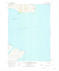
1963 Map of Chignik B-1
USGS Topo · Published 1978About this map
Chignik Bay dominates this coastal survey, where the maritime landscape of the Alaska Peninsula is defined by deep inlets and sharp topographical relief. To the north, Weasel Mountain rises abruptly above the shoreline near Hook Bay, with a small cluster of Cabins providing a rare sign of human habitation in this isolated environment. This area serves as a primary point of reference for the northern coast, while Cape Kumliun marks the northeastern entrance to the greater bay.
Find a feature on this map
11 named features on this map. Tap any name to fly to it.
Don’t see what you’re looking for? This feature index may not catch every label — zoom into the map to look around manually.
Map Details
Editions of this 1963 Chignik B-1 Map
2 editions found
Other maps of this area

1951 · Sutwik Island
USGS Topo · 1:250,000

1963 · Chignik B-2
USGS Topo · 1:63,360

1963 · Chignik B-1
USGS Topo · 1:63,360

1963 · Chignik A-2
USGS Topo · 1:63,360

1963 · Chignik C-1
USGS Topo · 1:63,360

1963 · Sutwik Island B-6
USGS Topo · 1:63,360
1963 · Chignik A-1
USGS Topo · 1:63,360

1963 · Chignik C-2
USGS Topo · 1:63,360

1963 · Sutwik Island
USGS Topo · 1:250,000

1963 · Sutwik Island C-6
USGS Topo · 1:63,360