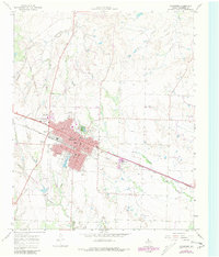
1967 Map of Childress
USGS Topo · Published 1981About this map
The Fort Worth and Denver railroad anchors the street grid of Childress, cutting diagonally through the town center and shaping its early 20th-century development. This 1967 survey reflects the community's established civic infrastructure, documenting several local education centers including Wilson Sch, East Ward Sch, and the Robert E Lee Sch. To the northeast of the main town site, the Rodeo Ground and Fair Park suggest the area's role as a regional hub for gatherings and livestock-related events.
Find a feature on this map
21 named features on this map. Tap any name to fly to it.
Don’t see what you’re looking for? This feature index may not catch every label — zoom into the map to look around manually.
Map Details
Editions of this 1967 Childress Map
2 editions found
Other maps of this area

1954 · Plainview
USGS Topo · 1:250,000

1958 · Plainview
USGS Topo · 1:250,000

1960 · Loco
USGS Topo · 1:62,500

1961 · Estelline
USGS Topo · 1:62,500

1967 · Buckle L Ranch
USGS Topo · 1:24,000

1967 · Hell Roaring Creek
USGS Topo · 1:24,000

1967 · Kirkland South
USGS Topo · 1:24,000

1967 · Kirkland North
USGS Topo · 1:24,000

1967 · Childress
USGS Topo · 1:24,000

1967 · Carey
USGS Topo · 1:24,000