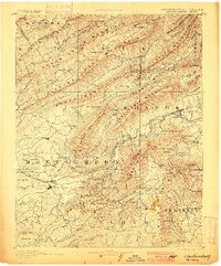
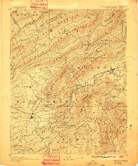
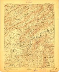
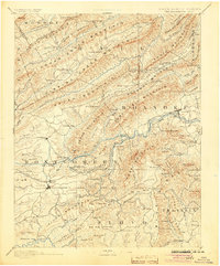
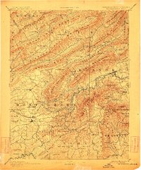
1890 Map of Christiansburg
USGS Topo · Published 1900About this map
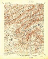
Christiansburg and Salem serve as the primary hubs in this late 19th-century survey of the Virginia and West Virginia highlands. The landscape is defined by parallel ridges like Potts Mountain and Catawba Mountain, while the Norfolk and Western Railroad navigates the valley floors, passing through the engineering landmark at Big Tunnel. This era was the height of the mineral springs resort culture, evidenced by the clustered prominence of Montgomery White Sulphur Sprs., Yellow Sulphur Sprs., and Alleghany Springs. Local commerce is grounded in riverside industry, with several family-run operations such as Mc Donalds Mill and Bennetts Mill lining the numerous forks and branches of the Roanoke River and Little River. Rural life is further mapped through remote post offices like Bradshaw P.O. and small communities such as Simmonsville and Fagg.
Find a feature on this map
161 named features on this map. Tap any name to fly to it.
Don’t see what you’re looking for? This feature index may not catch every label — zoom into the map to look around manually.
Map Details
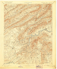
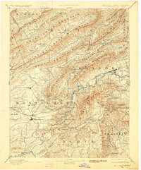
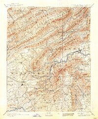
Editions of this 1890 Christiansburg Map
10 editions found

1890 edition
16.55 x 19.92 inches
1891 edition
16.57 x 19.94 inches
1895 edition
16.56 x 19.94 inches
1900 edition
16.53 x 19.95 inches
1904 edition
16.5 x 19.9 inches
1912 edition
16.53 x 19.93 inches
1920 edition
16.5 x 20 inches
1928 edition
16.5 x 19.9 inches
1938 edition
16.44 x 19.88 inches
1945 edition
16.96 x 20.86 inches
Historical Maps of Blacksburg Through Time
1 maps found