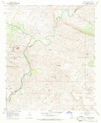
1968 Map of Christmas
USGS Topo · Published 1971About this map
The Christmas settlement and its industrial landscape define this 1960s study of the Gila Co Pinal Co border. Mining activity is central to the area, evidenced by the large Tailings Pond, a Conveyor, and several remote operations including Two Queens Mine and Pooles Mine. The Gila River cuts a deep path through the terrain, separating the Dripping Spring Mts from Lee Mountain and the Porphyry Granite Basin. The map captures a transition between the established ranching life at Young Ranch and Reese Ranch and the specialized extraction economy of the mid-century. High-elevation features like The Tablelands and Corral Mountain overlook a network of Jeep Trails and a Pack Trail leading toward the Old Mill (Ruin) at Little Gold Gulch, reflecting the region's rugged accessibility and history of prospecting.
Find a feature on this map
35 named features on this map. Tap any name to fly to it.
Don’t see what you’re looking for? This feature index may not catch every label — zoom into the map to look around manually.
Map Details
Editions of this 1968 Christmas Map
3 editions found
Other maps of this area

1910 · Ray
USGS Topo · 1:62,500

1911 · Winkelman
USGS Topo · 1:125,000

1913 · Winkelman
USGS Topo · 1:125,000

1915 · Christmas
USGS Topo · 1:62,500

1917 · Christmas
USGS Topo · 1:62,500

1949 · Holy Joe Peak
USGS Topo · 1:62,500

1949 · Winkelman
USGS Topo · 1:24,000

1949 · Winkelman
USGS Topo · 1:62,500

1949 · Saddle Mtn.
USGS Topo · 1:24,000

1949 · Brandenburg Mtn
USGS Topo · 1:24,000