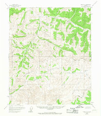
1955 Map of Circle A-1
USGS Topo · Published 1967About this map
The Salcha River and its numerous tributaries dominate this mid-century topographic survey of the interior Alaskan wilderness. Surveyed using photogrammetric methods in the 1950s, the map reveals a landscape defined by water and elevation, where names like Caribou Creek and Big Windy Creek hint at the local environment. A single Cabin stands as the only named structure, illustrating the sparse human presence in this region during the post-war era. The western boundary is marked by a large Military Reservation, while the Fairbanks North Star Borough line crosses through the eastern reaches. The terrain is a complex network of drainages including the Yukon Fork and South Fork Birch Creek, providing a detailed record of the drainage patterns and geographical landmarks of this section of the Yukon-Koyukuk region before more modern infrastructure or changes occurred.
Find a feature on this map
14 named features on this map. Tap any name to fly to it.
Don’t see what you’re looking for? This feature index may not catch every label — zoom into the map to look around manually.
Map Details
Editions of this 1955 Circle A-1 Map
3 editions found
Other maps of this area

1950 · Big Delta
USGS Topo · 1:250,000

1951 · Big Delta
USGS Topo · 1:250,000

1951 · Charley River
USGS Topo · 1:250,000

1951 · Eagle
USGS Topo · 1:250,000

1951 · Circle
USGS Topo · 1:250,000

1955 · Circle A-2
USGS Topo · 1:63,360

1955 · Circle A-1
USGS Topo · 1:63,360

1955 · Circle B-1
USGS Topo · 1:63,360

1955 · Circle B-2
USGS Topo · 1:63,360

1955 · Circle
USGS Topo · 1:250,000