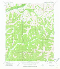
1954 Map of Circle A-6
USGS Topo · Published 1972About this map
Steese Highway cuts through the northern interior of Alaska in this mid-century topographic record, tracing a path just south of the Chatanika River. The landscape is dominated by a complex network of waterways, including the Little Chena River and Anaconda Creek, which carve through the high elevations between Twin Buttes and Davidson Flat. A notable piece of historical infrastructure is the Davidson Ditch, an extensive conduit built to support large-scale placer mining operations by transporting water across the rugged terrain.
Find a feature on this map
25 named features on this map. Tap any name to fly to it.
Don’t see what you’re looking for? This feature index may not catch every label — zoom into the map to look around manually.
Map Details
Editions of this 1954 Circle A-6 Map
4 editions found

Other maps of this area

1945 · Livengood
USGS Topo · 1:250,000

1949 · Fairbanks D-1
USGS Topo · 1:62,500

1950 · Fairbanks
USGS Topo · 1:250,000

1950 · Big Delta
USGS Topo · 1:250,000

1950 · Big Delta D-6
USGS Topo · 1:63,360

1951 · Big Delta
USGS Topo · 1:250,000

1951 · Fairbanks
USGS Topo · 1:250,000

1951 · Livengood
USGS Topo · 1:250,000

1951 · Circle
USGS Topo · 1:250,000

1951 · Circle A-5
USGS Topo · 1:63,360