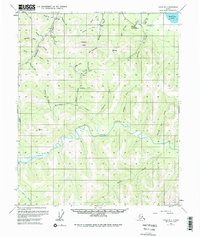
1955 Map of Circle B-2
USGS Topo · Published 1979About this map
Birch Creek meanders through this interior Alaska landscape, defining a valley where mining and aviation once anchored local activity. The presence of several mines and specifically noted Placer Mines along Deadwood Creek and Harrison Creek indicates the region's historical reliance on mineral extraction. High ground is marked by Ketchum Dome, while the valley floors are dotted with numerous cabins and shelter points for prospectors and travelers. A Tractor Trail provides a glimpse into the seasonal transport routes required to reach remote sites like the Circle Hot Springs Landing Strip. In the northeast corner, Medicine Lake stands as a quiet landmark amidst a network of drainage features with evocative names like Discovery Gulch and Nugget Gulch, which point to the gold-seeking heritage of the Yukon-Koyukuk region.
Find a feature on this map
39 named features on this map. Tap any name to fly to it.
Don’t see what you’re looking for? This feature index may not catch every label — zoom into the map to look around manually.
Map Details
Editions of this 1955 Circle B-2 Map
4 editions found
Other maps of this area

1951 · Circle
USGS Topo · 1:250,000

1955 · Circle B-3
USGS Topo · 1:63,360

1955 · Circle C-3
USGS Topo · 1:63,360

1955 · Circle A-2
USGS Topo · 1:63,360

1955 · Circle A-1
USGS Topo · 1:63,360

1955 · Circle B-1
USGS Topo · 1:63,360

1955 · Circle C-2
USGS Topo · 1:63,360

1955 · Circle A-3
USGS Topo · 1:63,360

1955 · Circle B-2
USGS Topo · 1:63,360

1955 · Circle C-1
USGS Topo · 1:63,360