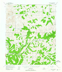
1954 Map of Circle B-5
USGS Topo · Published 1964About this map
Davidson Ditch winds through this Interior Alaska terrain, serving as a significant engineering feature of the early 20th-century gold mining industry. This water delivery system, accompanied by a flume, was built to provide hydraulic power for distant mining operations. The landscape is dominated by the drainages of the Chatanika River, Faith Creek, and McManus Creek, which converge in the southern portion of the quadrangle. High points like Mount Prindle and VABM Hope overlook a network of tributary streams, many of which bear names associated with prospecting. The Steese Highway provides the primary corridor for movement, passing the Montana Creek ARC Camp and the Sourdough BM Camp. Scattered cabins and an isolated mine indicate the presence of remote seasonal work and subsistence living in this subarctic environment during the mid-1950s.
Find a feature on this map
40 named features on this map. Tap any name to fly to it.
Don’t see what you’re looking for? This feature index may not catch every label — zoom into the map to look around manually.
Map Details
Editions of this 1954 Circle B-5 Map
4 editions found

Other maps of this area

1951 · Circle
USGS Topo · 1:250,000

1951 · Circle A-5
USGS Topo · 1:63,360

1951 · Circle C-6
USGS Topo · 1:63,360

1952 · Circle A-4
USGS Topo · 1:63,360

1952 · Circle B-4
USGS Topo · 1:63,360

1952 · Circle C-4
USGS Topo · 1:63,360

1952 · Circle C-5
USGS Topo · 1:63,360

1952 · Circle A-5
USGS Topo · 1:63,360

1954 · Circle C-5
USGS Topo · 1:63,360

1954 · Circle A-6
USGS Topo · 1:63,360