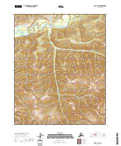
2018 Map of Circle C-6 NW
USGS Topo · Published 2018About this map
Beaver Creek winds through the northern reaches of this interior Alaskan landscape, defining the low-lying drainage patterns that contrast with the high elevations found elsewhere on the quadrangle. The topography is dominated by steep ridges and complex creek systems that feed into the larger basin. In the southeastern corner, the land rises sharply toward Lime Peak, a prominent topographical landmark that anchors the surrounding wilderness. The drainage network is further defined by Muscot Cr and Warren Cr, which carve through narrow valleys between the upland summits. This map captures the territory within the public land survey townships of T11N, T10N, and T9N, illustrating the primitive state of this remote drainage basin. Significant elevation changes are marked by Sheep Cr in the southwest, showing the transition from mountain flanks to the valley floors.
Find a feature on this map
11 named features on this map. Tap any name to fly to it.
Don’t see what you’re looking for? This feature index may not catch every label — zoom into the map to look around manually.
Map Details
Editions of this 2018 Circle C-6 NW Map
This is the sole edition of this map. No revisions or reprints were ever made.
Other maps of this area

1945 · Livengood
USGS Topo · 1:250,000

1951 · Livengood
USGS Topo · 1:250,000

1951 · Circle
USGS Topo · 1:250,000

1951 · Circle D-6
USGS Topo · 1:63,360

1951 · Livengood C-1
USGS Topo · 1:63,360

1951 · Circle C-6
USGS Topo · 1:63,360

1952 · Livengood D-1
USGS Topo · 1:63,360

1954 · Livengood C-1
USGS Topo · 1:63,360

1954 · Circle D-6
USGS Topo · 1:63,360
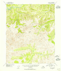
1954 · Circle C-6
USGS Topo · 1:63,360