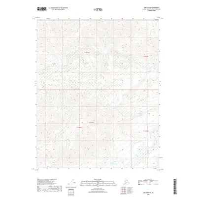
2018 Map of Circle D-6 SW
USGS Topo · Published 2018About this map
Victoria Mtn anchors the high ground of this interior Alaska wilderness, serving as the primary drainage divide for a network of northern waterways. The terrain is defined by the winding course of Victoria Creek, which cuts through the northwestern quadrant, while the southern reaches are dominated by the wide, marshy corridor of Beaver Creek. This 2018 survey illustrates a landscape largely untouched by infrastructure, where natural features like Long Cr and Squaw Cr define the movement through the bush. The hydrology of the region is further detailed by Sand Cr and Yellow Cr, providing a precise record of the Unorganized Borough’s watershed before environmental shifts alter these remote channels.
Find a feature on this map
11 named features on this map. Tap any name to fly to it.
Don’t see what you’re looking for? This feature index may not catch every label — zoom into the map to look around manually.
Map Details
Editions of this 2018 Circle D-6 SW Map
This is the sole edition of this map. No revisions or reprints were ever made.
Other maps of this area

1945 · Livengood
USGS Topo · 1:250,000

1951 · Livengood
USGS Topo · 1:250,000

1951 · Circle
USGS Topo · 1:250,000

1951 · Circle D-6
USGS Topo · 1:63,360

1951 · Livengood C-1
USGS Topo · 1:63,360

1951 · Circle C-6
USGS Topo · 1:63,360

1952 · Livengood D-1
USGS Topo · 1:63,360

1954 · Livengood C-1
USGS Topo · 1:63,360

1954 · Circle D-6
USGS Topo · 1:63,360
1954 · Circle C-6
USGS Topo · 1:63,360