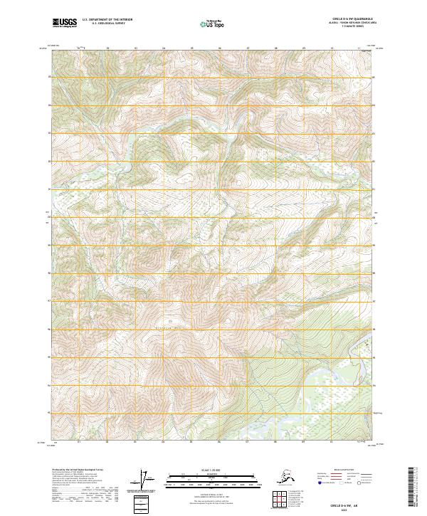
2023 Map of Circle D-6 SW
USGS Topo · Published 2023About this map
The White Mountains National Recreation Area dominates this interior Alaska landscape, characterized by high-elevation ridges and a complex network of drainages. The most prominent peak, Victoria Mtn, rises above the surrounding valleys of Victoria Creek and Long Creek. The southern portion of the sheet is defined by the Beaver Wild and Scenic River, where the waterway winds through the lowlands near the confluence of Yellow Creek. This terrain illustrates the transition from the high ridges of the White Mountains to the broader river basins of the Yukon-Koyukuk region. The absence of roads or permanent settlements highlights the wilderness character of the area, where hydrology like White Creek and Sand Creek dictates the movement across the landscape. The map provides a clear look at the township and range lines, including t11n r4e and t12n r5e, which overlay this protected recreational and conservation corridor.
Find a feature on this map
13 named features on this map. Tap any name to fly to it.
Don’t see what you’re looking for? This feature index may not catch every label — zoom into the map to look around manually.
Map Details
Editions of this 2023 Circle D-6 SW Map
This is the sole edition of this map. No revisions or reprints were ever made.
Other maps of this area

1945 · Livengood
USGS Topo · 1:250,000

1951 · Livengood
USGS Topo · 1:250,000

1951 · Circle
USGS Topo · 1:250,000

1951 · Circle D-6
USGS Topo · 1:63,360

1951 · Livengood C-1
USGS Topo · 1:63,360

1951 · Circle C-6
USGS Topo · 1:63,360

1952 · Livengood D-1
USGS Topo · 1:63,360

1954 · Livengood C-1
USGS Topo · 1:63,360

1954 · Circle D-6
USGS Topo · 1:63,360
1954 · Circle C-6
USGS Topo · 1:63,360