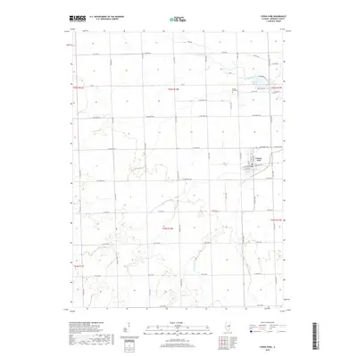
2018 Map of Cissna Park
USGS Topo · Published 2018About this map
Cissna Park anchors this central Illinois landscape, showing the town's grid and surrounding agricultural sections during the late 2010s. The village's layout is centered near W Garfield Ave and E Garfield Ave, reflecting a traditional Midwestern rail-side development pattern that has transitioned into a local service hub. Outside the residential blocks, the Cissna Park Cem sits north of town near the headwaters of local drainage systems. The landscape is defined by its watercourses, including the winding Little Mud Creek to the north and Pigeon Creek to the south. Near the northeastern corner of the village, Kellar Lake and streets like Lakeshore Dr indicate more recent residential expansion around local water features, contrasting with the long-established township-and-range road grid that divides the surrounding fields.
Find a feature on this map
36 named features on this map. Tap any name to fly to it.
Don’t see what you’re looking for? This feature index may not catch every label — zoom into the map to look around manually.
Map Details
Editions of this 2018 Cissna Park Map
This is the sole edition of this map. No revisions or reprints were ever made.
Other maps of this area

1924 · Paxton
USGS Topo · 1:62,500

1927 · Paxton
USGS Topo · 1:62,500

1936 · Potomac
USGS Topo · 1:62,500

1939 · Cissna Park
USGS Topo · 1:62,500

1948 · Buckley
USGS Topo · 1:62,500

1949 · Cissna Park
USGS Topo · 1:62,500

1949 · Buckley
USGS Topo · 1:62,500

1949 · Paxton
USGS Topo · 1:62,500

1953 · Danville
USGS Topo · 1:250,000

1955 · Danville
USGS Topo · 1:250,000