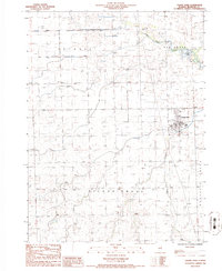
1986 Map of Cissna Park
USGS Topo · Published 1986About this map
The village of Cissna Park anchors this mid-1980s survey, surrounded by the geometric section lines of Iroquois County. This region is characterized by its organized agricultural drainage, with Little Mud Creek and Cissna Creek winding through the townships of Ash Grove, Artesia, and Pigeon Grove. The landscape reflects a deeply established farming community, punctuated by local landmarks like the Zion church and a local Cem.
Find a feature on this map
12 named features on this map. Tap any name to fly to it.
Don’t see what you’re looking for? This feature index may not catch every label — zoom into the map to look around manually.
Map Details
Editions of this 1986 Cissna Park Map
This is the sole edition of this map. No revisions or reprints were ever made.
Other maps of this area

1924 · Paxton
USGS Topo · 1:62,500

1927 · Paxton
USGS Topo · 1:62,500

1936 · Potomac
USGS Topo · 1:62,500

1939 · Cissna Park
USGS Topo · 1:62,500

1948 · Buckley
USGS Topo · 1:62,500

1949 · Cissna Park
USGS Topo · 1:62,500

1949 · Buckley
USGS Topo · 1:62,500

1949 · Paxton
USGS Topo · 1:62,500

1953 · Danville
USGS Topo · 1:250,000

1955 · Danville
USGS Topo · 1:250,000