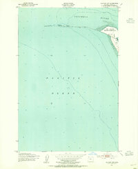
1951 Map of Clatsop Spit
USGS Topo · Published 1955About this map
Fort Stevens Military Reservation anchors the coastal landscape where the Columbia River meets the Pacific Ocean. This coastal survey documents the strategic maritime and military infrastructure at the mouth of the river during the early 1950s. The geography is dominated by the shifting sands of Clatsop Spit, where a Lookout Tower and a South Jetty monitor the treacherous transition from river to sea. Navigational hazards and engineering efforts are visible throughout the waters, including a Submerged Breakwater, various Piling locations, and a Tidal Flat. The presence of a Bridge Unsafe label near the spit suggests the physical challenges of maintaining access in this dynamic environment of salt spray and moving dunes.
Find a feature on this map
11 named features on this map. Tap any name to fly to it.
Don’t see what you’re looking for? This feature index may not catch every label — zoom into the map to look around manually.
Map Details
Editions of this 1951 Clatsop Spit Map
3 editions found
Other maps of this area

1919 · Astoria
USGS Topo · 1:62,500

1938 · Cape Disappointment
USGS Topo · 1:62,500

1938 · Fort Columbia
USGS Topo · 1:62,500

1939 · Astoria
USGS Topo · 1:62,500

1943 · Fort Columbia
USGS Topo · 1:62,500

1943 · Copalis Beach
USGS Topo · 1:250,000

1949 · Chinook
USGS Topo · 1:24,000

1949 · Gearhart
USGS Topo · 1:24,000
1949 · Cape Disappointment
USGS Topo · 1:24,000

1951 · Copalis Beach
USGS Topo · 1:250,000