1891 Map of Clay Center
USGS Topo · Published 1938About this map
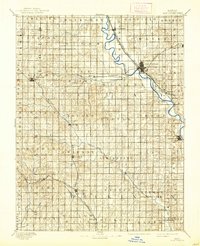
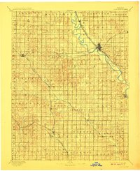
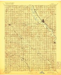
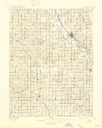
The Republican River carves a winding path through the heart of north-central Kansas, serving as the primary geographic anchor for the late 19th-century settlements of Clay Center, Morganville, and Wakefield. This reconnaissance survey, conducted by R.M. Towson, reveals a landscape dominated by the rapid expansion of the steam era. Three major rail lines converge here, including the Chicago Rock Island and Pacific Railway and the Union Pacific Railway, which facilitated the growth of smaller agricultural hubs like Idana, Longford, and Manchester. The intricate topography around Chapman Creek and Miller Creek highlights the transition from the river bottomlands to the rolling prairie divides. Genealogists can locate early community centers such as Sutphen Mills and Green, while the clearly defined township boundaries like Gill, Athelstane, and Exeter provide essential context for land patent research during this formative period of Kansas development.
Find a feature on this map
52 named features on this map. Tap any name to fly to it.
Don’t see what you’re looking for? This feature index may not catch every label — zoom into the map to look around manually.
Map Details
Editions of this 1891 Clay Center Map
5 editions found
Other maps of this area

1886 · Junction City
USGS Topo · 1:125,000

1889 · Marysville
USGS Topo · 1:125,000

1889 · Junction City
USGS Topo · 1:125,000

1889 · Abilene
USGS Topo · 1:125,000

1889 · Parkerville
USGS Topo · 1:125,000

1891 · Clay Center
USGS Topo · 1:125,000

1892 · Concordia
USGS Topo · 1:125,000

1892 · Salina
USGS Topo · 1:125,000

1892 · Minneapolis
USGS Topo · 1:125,000

1893 · Washington
USGS Topo · 1:125,000