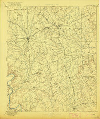
1894 Map of Cleburne
USGS Topo · Published 1921About this map
The Gulf Colorado and Santa Fe Railway and the Missouri Kansas and Texas Railway converge at Cleburne, establishing this area as a vital rail hub in the late nineteenth century. This survey, conducted by Henry Gannett and his team, captures the transition of the north Texas landscape from open prairie into a network of organized farm settlements and cattle towns. To the south, the winding path of the Brazos River forms a natural boundary, passing the site of Fort Graham and the settlement of Kimball. The map documents numerous small communities that served as local anchors, such as Files Valley, Marystown, and Buel, many of which were tied to the seasonal flow of creeks like Chambers Creek and Nolands River. The detailed topography includes prominent landmarks like Caddo Peak and Brushy Knob, providing a clear view of the region's physical character before modern urbanization altered the local drainage and road networks.
Find a feature on this map
70 named features on this map. Tap any name to fly to it.
Don’t see what you’re looking for? This feature index may not catch every label — zoom into the map to look around manually.
Map Details
Editions of this 1894 Cleburne Map
5 editions found
Other maps of this area

1888 · Meridian
USGS Topo · 1:125,000

1889 · Granbury
USGS Topo · 1:125,000

1891 · Weatherford
USGS Topo · 1:125,000

1891 · Dallas
USGS Topo · 1:125,000

1891 · Cleburne
USGS Topo · 1:125,000

1892 · Waco
USGS Topo · 1:125,000

1893 · Dallas
USGS Topo · 1:125,000

1893 · Weatherford
USGS Topo · 1:125,000

1894 · Meridian
USGS Topo · 1:125,000

1894 · Cleburne
USGS Topo · 1:125,000