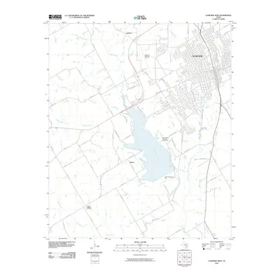
2010 Map of Cleburne West
USGS Topo · Published 2010About this map
Lake Pat Cleburne dominates the central landscape of this Johnson County quadrangle, showing the significant water management and recreation infrastructure serving the nearby city of Cleburne. The reservoir is bounded by the Lake Pat Cleburne Dam to the south, while its western shores are marked by the small communities of Burton and Lebanon. The city’s residential and industrial footprint extends into the northeastern corner, where the street grid gives way to the Cleburne Municipal Airport and the Pat Cleburne Municipal Golf Course.
Find a feature on this map
59 named features on this map. Tap any name to fly to it.
Don’t see what you’re looking for? This feature index may not catch every label — zoom into the map to look around manually.
Map Details
Editions of this 2010 Cleburne West Map
This is the sole edition of this map. No revisions or reprints were ever made.
Other maps of this area

1889 · Granbury
USGS Topo · 1:125,000

1891 · Cleburne
USGS Topo · 1:125,000

1894 · Cleburne
USGS Topo · 1:125,000

1924 · Cleburne 3-B
USGS Topo · 1:48,000

1924 · Granbury 4-a
USGS Topo · 1:48,000

1927 · Blum
USGS Topo · 1:62,500

1928 · Godley
USGS Topo · 1:62,500

1931 · Morgan
USGS Topo · 1:62,500

1954 · Dallas
USGS Topo · 1:250,000

1958 · Dallas
USGS Topo · 1:250,000