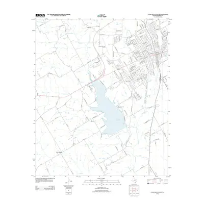
2012 Map of Cleburne West
USGS Topo · Published 2012About this map
Lake Pat Cleburne dominates the central landscape of this West Texas quadrangle, serving as a primary reservoir for the surrounding region. The water system is intricately fed by the W Fork Nolan River and several smaller tributaries including Town Br and Robinson Br, which converge to form the Nolan River south of the dam. The urban expansion of Cleburne is evident on the eastern edge of the sheet, where dense street grids meet more dispersed rural developments and outlying settlements such as Lebanon, Burton, and Lone Willow. Significant public infrastructure is documented, including the Cleburne Municipal Airport and the Pat Cleburne Municipal Golf Course. Historically significant water sources like Cleburne Spring are also noted, providing a look at the natural features that originally influenced the growth of this Johnson County seat.
Find a feature on this map
154 named features on this map. Tap any name to fly to it.
Don’t see what you’re looking for? This feature index may not catch every label — zoom into the map to look around manually.
Map Details
Editions of this 2012 Cleburne West Map
This is the sole edition of this map. No revisions or reprints were ever made.
Other maps of this area

1889 · Granbury
USGS Topo · 1:125,000

1891 · Cleburne
USGS Topo · 1:125,000

1894 · Cleburne
USGS Topo · 1:125,000

1924 · Cleburne 3-B
USGS Topo · 1:48,000

1924 · Granbury 4-a
USGS Topo · 1:48,000

1927 · Blum
USGS Topo · 1:62,500

1928 · Godley
USGS Topo · 1:62,500

1931 · Morgan
USGS Topo · 1:62,500

1954 · Dallas
USGS Topo · 1:250,000

1958 · Dallas
USGS Topo · 1:250,000