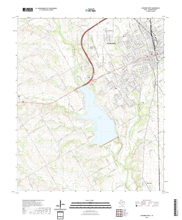
2022 Map of Cleburne West
USGS Topo · Published 2022About this map
Lake Pat Cleburne dominates the central landscape of this Johnson County region, formed by the damming of the Nolan River. To the northeast, the city of Cleburne serves as a dense residential and civic hub, containing the Guinn Justice Center and the Old Cleburn Cem. The town's educational and institutional footprint is visible through the Hill College Main Campus and the Hill College Technical Center, while the Cleburne Regional Airport anchors the northern approach.
Find a feature on this map
55 named features on this map. Tap any name to fly to it.
Don’t see what you’re looking for? This feature index may not catch every label — zoom into the map to look around manually.
Map Details
Editions of this 2022 Cleburne West Map
This is the sole edition of this map. No revisions or reprints were ever made.
Other maps of this area

1889 · Granbury
USGS Topo · 1:125,000

1891 · Cleburne
USGS Topo · 1:125,000

1894 · Cleburne
USGS Topo · 1:125,000

1924 · Cleburne 3-B
USGS Topo · 1:48,000

1924 · Granbury 4-a
USGS Topo · 1:48,000

1927 · Blum
USGS Topo · 1:62,500

1928 · Godley
USGS Topo · 1:62,500

1931 · Morgan
USGS Topo · 1:62,500

1954 · Dallas
USGS Topo · 1:250,000

1958 · Dallas
USGS Topo · 1:250,000